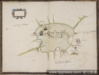
EditorialDrawing of Lough Neagh, Ireland . STATE of the Fortes of Ireland as they weare in the yeare 1624;" fourteen coloured plans of the river of Waterford and the forts of Duncannon, Waterford, Haleboline [Cork Haven], Cork, Kinsale, Culmore, Galway, Bannaho...
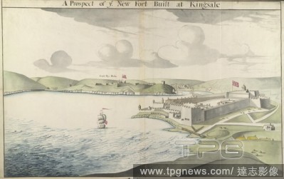
EditorialA view of Charles Fort at Kinsale on the right-hand side; ships on the water on the left; Kinsale in the distance; hills throughout the scene. A Prospect of ye New Fort Built at Kingsale. c. 1680. Pen and black ink with watercolour. Source: Maps K.Top....
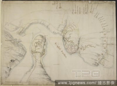
EditorialCharles Fort at Kinsale on the right-hand side; boats on the water on the left; Castle Park Fort on a hill in the distance. Kinsale Harbour, shewing Fort Charles and Castle Park Fort. c. 1689. Pen and black ink with watercolour over pencil. Source: Map...
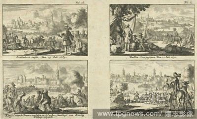
EditorialPlan of the siege of Kinsale, October 1690. The town, harbour, River Brandon, Fort Charles and Old Fort. The positions of the English and Allied troops are shown, with trenches, batteries and manoeuvres of besiegers indicated in coloured inks. circa 16...
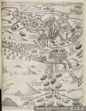
EditorialMap illustration of army besieging Kinsale in Ireland in 1601. Battle site. . The Army of the Kinge of Spayne commanded by Don John de Aguila besieged in the towne of Kinsale. London : A. Mathewes for R. Milbourne, 1633. Source: 186.d.8 Last folded map...
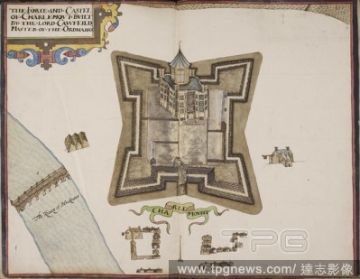
EditorialIllustration of Charlemont castle. An album of the forts and castles of Ireland. . STATE of the Fortes of Ireland as they weare in the yeare 1624. Image from "State of the Fortes of Ireland as they weare in the yeare 1624;" fourteen coloured plans of t...
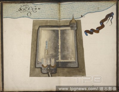
EditorialIllustration of Shannon castle. A book of plans of Irish castles. . STATE of the Fortes of Ireland as they weare in the yeare 1624. From "State of the Fortes of Ireland as they weare in the yeare 1624;" fourteen coloured plans of the river of Waterford...


 Loading