EditorialPresident Hassan Sheikh Mohamud of Somalia addresses the United Nations General Assembly at U.N. headquarters in New York on Sept. 22, 2022. (Dave Sanders/The New York Times)
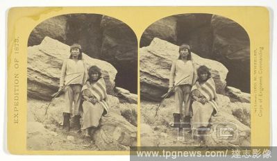
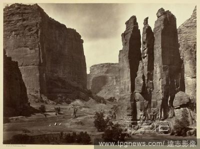
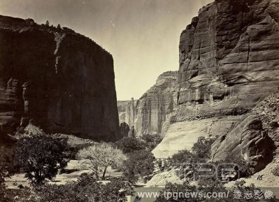
EditorialHead of Ca?on de Chelle, Looking Down. Walls about 1200 feet in height. Timothy O'Sullivan; American, born Ireland, 1840-1882. Date: 1873. Dimensions: 20.2 x 27.7 cm (image/paper); 38.2 x 49.9 cm (album page). Albumen print, No. 16 from the album "Geog...
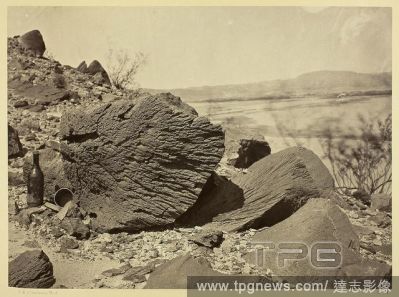
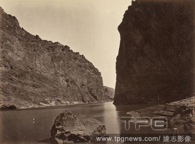
EditorialBlack Ca?on, Colorado River, Looking Below, Near Camp 7. Timothy O'Sullivan; American, born Ireland, 1840-1882. Date: 1871. Dimensions: 20.4 x 27.5 cm (image/paper); 39.3 x 49.9 cm (mount). Albumen print, from the album "Geographical & Geological Explo...
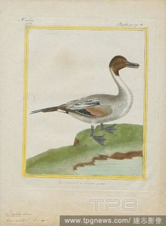
EditorialDafila acuta, Print, The pintail or northern pintail (Anas acuta) is a duck with wide geographic distribution that breeds in the northern areas of Europe, Asia and North America. It is migratory and winters south of its breeding range to the equator. U...
EditorialDafila acuta, Print, The pintail or northern pintail (Anas acuta) is a duck with wide geographic distribution that breeds in the northern areas of Europe, Asia and North America. It is migratory and winters south of its breeding range to the equator. U...
EditorialDafila acuta, Print, The pintail or northern pintail (Anas acuta) is a duck with wide geographic distribution that breeds in the northern areas of Europe, Asia and North America. It is migratory and winters south of its breeding range to the equator. U...
EditorialDafila acuta, Print, The pintail or northern pintail (Anas acuta) is a duck with wide geographic distribution that breeds in the northern areas of Europe, Asia and North America. It is migratory and winters south of its breeding range to the equator. U...
EditorialDafila acuta, Print, The pintail or northern pintail (Anas acuta) is a duck with wide geographic distribution that breeds in the northern areas of Europe, Asia and North America. It is migratory and winters south of its breeding range to the equator. U...
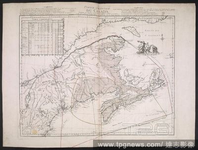
EditorialA French copy of an English map, published during the American Revolutionary War, showing the eastern part of Canada. Geographical detail extends from Cape Breton in the east down the Saint Lawrence River as far as Montr??al, and from the coast of Labr...
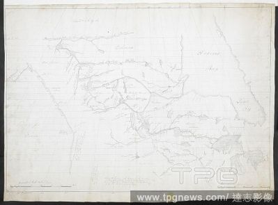
EditorialMap of North-West Canada; circa 1788. R.U.S.I. MAPS. Vol. LXXIII (1-13). 18th century. 1:7300000 approx. 'Geographical miles 60 to a degree'. Scale bar of 500 miles (= 5 inches). However a second scale 'British statute miles, 691/2 to a degree'; scale ...
EditorialA map of Nova Scotia and Cape Breton. Geographical detail extends from Cape Breton in the east down the Saint Lawrence River as far as Montr??al, and from the coast of Labrador in the north to Boston Harbour in the south. A NEW MAP of NOVA SCOTIA and C...
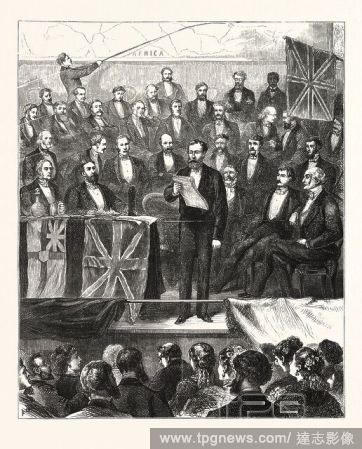
EditorialAFRICAN EXPLORATION : LIEUT. CAMERON READING AN ACCOUNT OF HIS ADVENTURES IN CENTRAL AFRICA BEFORE THE ROYAL GEOGRAPHICAL SOCIETY, AT ST. JAMES'S HALL, ON TUESDAY, APRIL 11TH., LONDON, ENGRAVING 1876, UK, britain, british, europe, united kingdom, great...
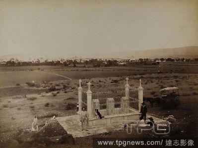
EditorialWilliam Henry Jackson, Quer?taro, Mexico. Monument to Maximilian von Habsburg, albumin paper, black and white positive process, image size: height: 25 cm; width: 33.6 cm, inscription: verso: in lead: v. Hesse - Wartegg, Geographical Society, in Hamburg...
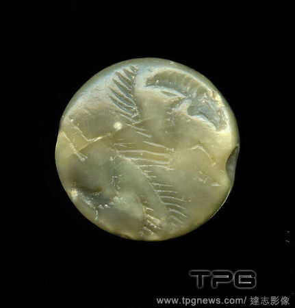
EditorialStamp seal (antipodic horse protomes), Soapstone, cut, drilled, steatite, Total: Diameter: 2 cm; Depth: 0.63 cm, Body jewelry, glyptic, horse, The lenticular (lentoid) gem is pierced and served as an amulet. The picture shows the front bodies of a wing...
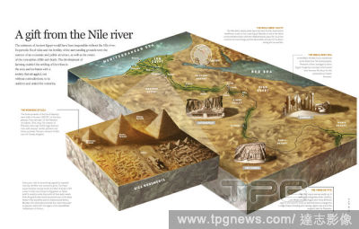
EditorialA Geographical and Commercial View of Northern Central Africa, containing a particular account of the course and termination of the great river Niger in the Atlantic Ocean, 1820.


 Loading