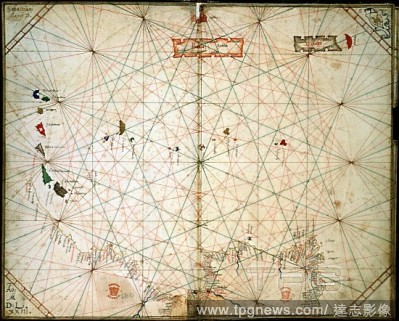
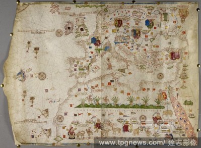
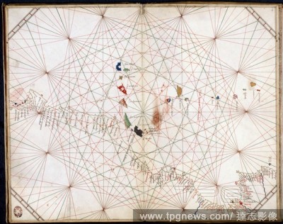
EditorialChart of the coasts of Europe, Asia Minor and north Africa; with the Azores, Madeira, Canary Islands, the Mediterranean Sea and Black Sea. Italy [Ancona]; 1470. Source: Add. 31318 A,. Language: Italian.
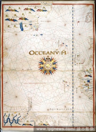
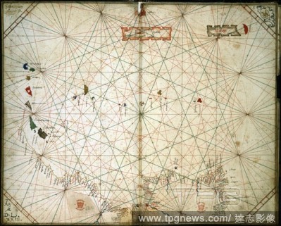
EditorialChart of the Eastern Atlantic. Portolano. Italy; 1463. [Whole chart] Chart of the west coasts of Spain, Portugal, and Africa to the Canary Islands, including Madeira and the Azores Image taken from Portolano. Originally published/produced in Italy; 1...
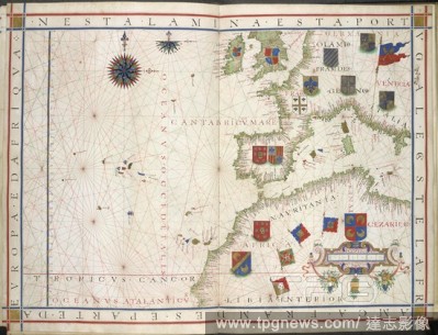
EditorialChart of Western Europe. Universalis Orbis Hydrographia. Portugal; 1573. [Whole chart] Chart of Western Europe, from the British isles, the eastern Altlantic with the Canary islands and Azores; the Iberian peninsula and the western Mediterranean Sea to...
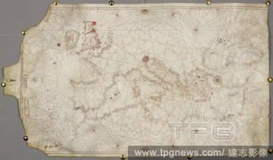
EditorialChart of the Atlantic Ocean. Portolano. Spain; before 1600. [Whole chart] Chart of the Atlantic Ocean, with Ireland, Portugal, and part of the west coast of Africa, including the Azores, Madeira, Canary Islands, and Cape Verde Islands. The western Atla...
EditorialMap of Europe, Asia Minor, and Africa, as far south as Cape Rosso; with the Azores, Madeira, Canary Islands, Cape Verde Islands.The Mediterranean Sea, Black Sea, Red Sea, and coast of Arabia. The map is ornamented with drawings of rulers, including the...
EditorialChart of the coasts of Europe, Asia Minor and north Africa; with the Azores, Madeira, Canary Islands, the Mediterranean Sea and Black Sea. Italy [Ancona]; 1470. Source: Add. 31318 A,. Language: Italian.
EditorialAzores and Canary Islands. Portolano. Italy [Venice]; 1473. [Whole chart] Chart of the Azores and Canary Islands, with the Atlantic coast from Cape Mondego to south of Cape Bianco Image taken from Portolano. Originally published/produced in Italy [Ve...
EditorialChart of the Eastern Atlantic. Portolano. Italy; 1463. [Whole chart] Chart of the west coasts of Spain, Portugal, and Africa to the Canary Islands, including Madeira and the Azores Image taken from Portolano. Originally published/produced in Italy; 1...
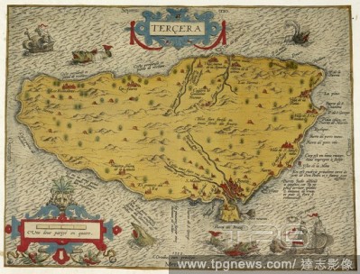
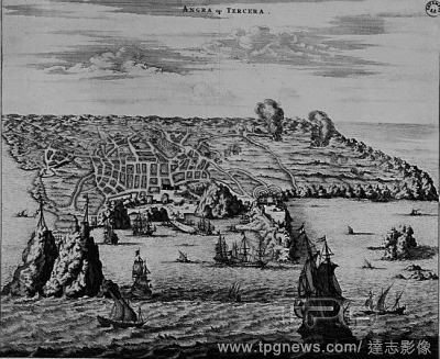
EditorialMap of the island of Tercera or Terciera in the Azores islands chain. Antwerp : Ortelius, 1582. Copperplate engraving. Source: Maps CC.5.a.517. Language: French.
EditorialChart of Western Europe. Universalis Orbis Hydrographia. Portugal; 1573. [Whole chart] Chart of Western Europe, from the British isles, the eastern Altlantic with the Canary islands and Azores; the Iberian peninsula and the western Mediterranean Sea to...
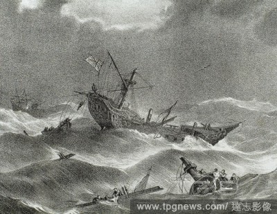
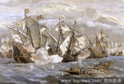
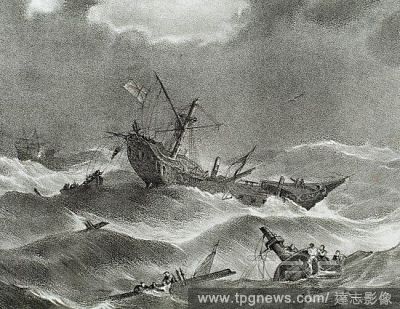
EditorialAnglo-Spanish War (1585-1604). Conflict between the kingdoms of Spain and England. (King of Spain Philip III and KIng of England James I). Battle near Azores Islands. Engraving. 19th century.
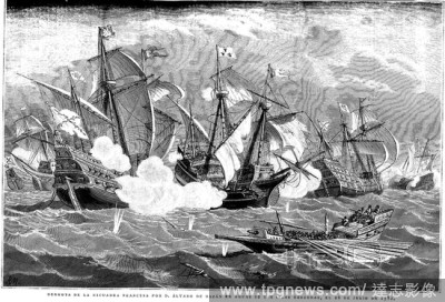
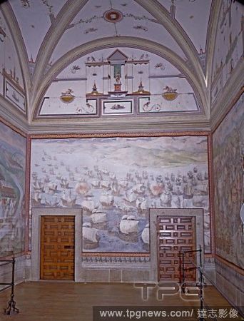
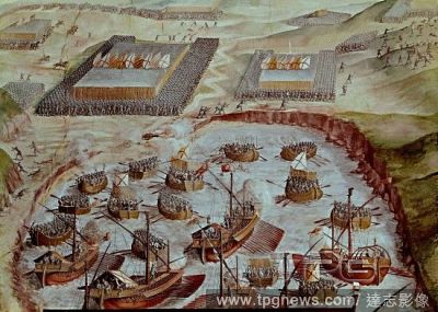
EditorialDERROTA DE LA ESCUADRA FRANCESA POR DON ALVARO DE BAZAN (1536-1588), EN AGUAS DE LAS ISLAS TERCERAS (AZORES) EL 26 DE JULIO DE 1582. S. XVI. Grabado.
EditorialEspa?a. Siglo XVI. Batalla naval de las Islas Terceras (Azores). Derrota de la escuadra francesa por Don Alvaro de Baz?n (Granada, 1526-Lisboa, 1588) en el a?o 1582. Grabado de 1888.
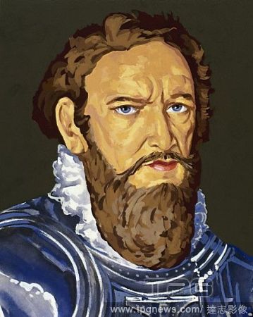
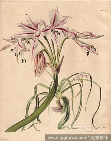
EditorialENRIQUE EL NAVEGANTE (Oporto, 1394-Sagres, 1460) Principe portugu?s, hijo de Juan I. Explor? Africa. En su palacio de Sagres fund? una escuela de navegaci?n. Descubri? las islas de Madera (1419), el Cabo Blanco (1441), el Senegal (1445), las Azores (14...
EditorialAnglo-Spanish War (1585-1604). Conflict between the kingdoms of Spain and England. (King of Spain Philip III and KIng of England James I). Battle near Azores Islands. Engraving. 19th century.
EditorialEspa?a. Siglo XVI. Batalla naval de las Islas Terceras (Azores). Derrota de la escuadra francesa por Don Alvaro de Baz?n (Granada, 1526-Lisboa, 1588) en el a?o 1582. Grabado de 1888.
EditorialDERROTA DE LA ESCUADRA FRANCESA POR DON ALVARO DE BAZAN (1536-1588), EN AGUAS DE LAS ISLAS TERCERAS (AZORES) EL 26 DE JULIO DE 1582. S. XVI. Grabado.


 Loading