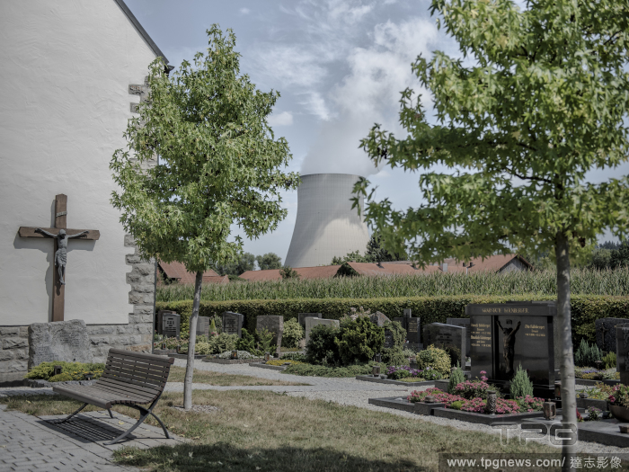
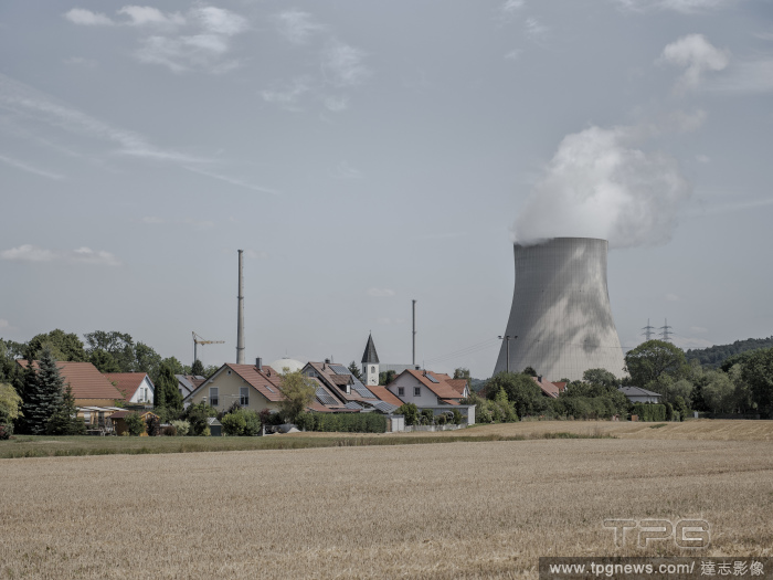
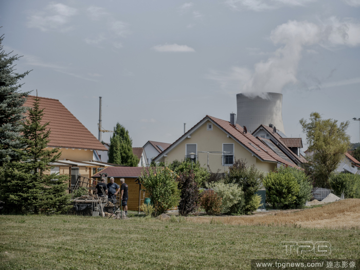
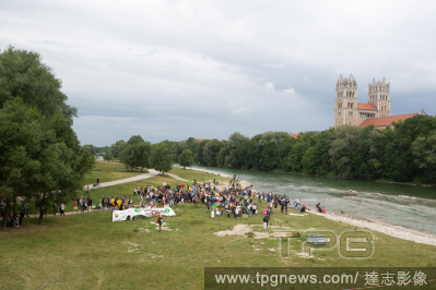
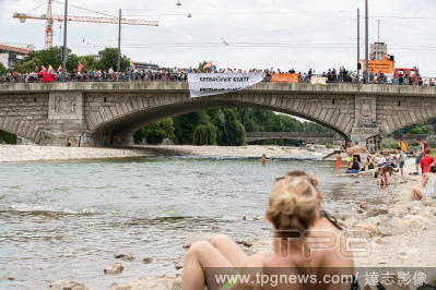
EditorialThe village of Wattenbacherau at the foot of the Isar II nuclear power plant in Germany on July 28, 2022. (Laetitia Vancon/The New York Times)
Editorial The village of Wattenbacherau at the foot of the Isar II nuclear power plant in Germany on July 28, 2022. (Laetitia Vancon/The New York Times)
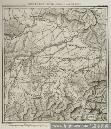
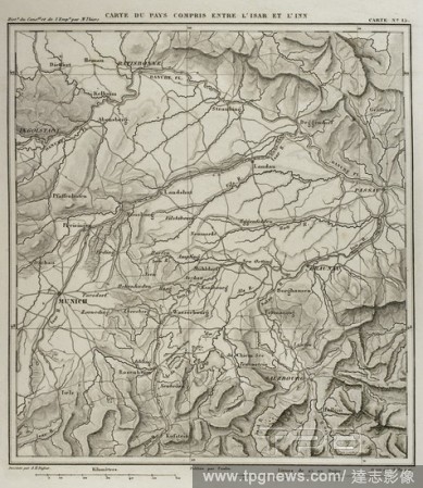
EditorialNapoleonic map. Territory between the German rivers Inn and Isar, tributaries of the Danube. Atlas de l'Histoire du Consulat et de l'Empire. History of the Consulate and the Empire of France under Napoleon by Marie Joseph Louis Adolphe Thiers (1797-187...
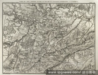
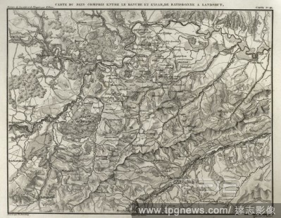
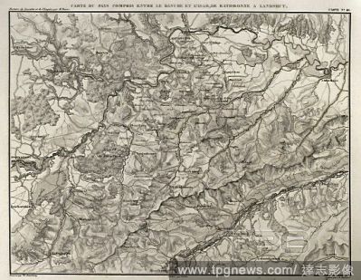
EditorialNapoleonic map. Territory between the Danube and Isar rivers, from Regensburg to Landshut (Germany). Atlas de l'Histoire du Consulat et de l'Empire. History of the Consulate and the Empire of France under Napoleon by Marie Joseph Louis Adolphe Thiers (...
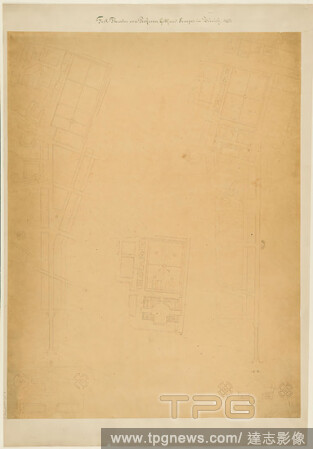
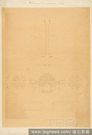
EditorialGottfried Semper, site plan for the Richard-Wagner-Festspielhaus in the Glaspalast in Munich (Residenz-Isar), tracing paper, drawing, pen-and-ink drawing, sheet size: height: 71.8 cm; width: 54.4 cm, inscribed: recto on the cardboard: in ink: Fest-Thea...
EditorialGottfried Semper, site plan for the Richard Wagner Festival Theater in the Glass Palace in Munich (Isar Bridge), tracing paper, drawing, pen-and-ink drawing, sheet size: height: 72.2 cm; width: 53.5 cm, inscribed: recto on the cardboard: in ink: Fest-T...
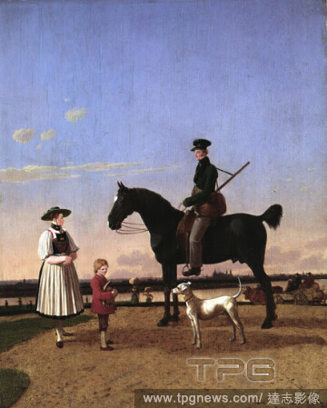
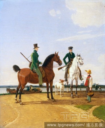
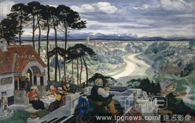
EditorialWilhelm von Kobell, A Huntsman and a Peasant Woman by the Isar River with a View of Munich, Wilhelm von Kobell (German, Mannheim 17661853 Munich), 1823, Oil on wood, 9 7/8 x 8 in. (25.1 x 20.3 cm), Paintings.
EditorialHunter and Lord at the River Isar with View of Munich, 1823. Wilhelm von Kobell (German, 1766-1853). Oil on wood panel; framed: 38 x 33.5 x 6 cm (14 15/16 x 13 3/16 x 2 3/8 in.); unframed: 25 x 20.6 cm (9 13/16 x 8 1/8 in.).
EditorialGerman landscape (Isar landscape), 1900-1901, tempera on linden wood, 63.5 x 99 cm, signed and dated center left, above the house entrance: ALBERT WELTI, 1900-1901, Albert Welti, Z?rich 1862?1912 Bern.
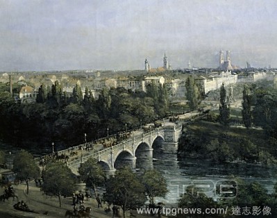
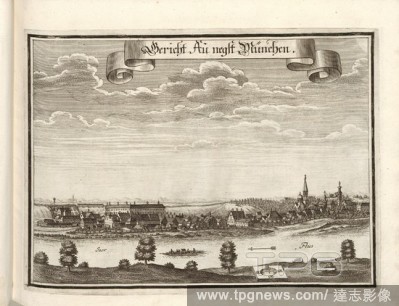
EditorialCourt Au negst Munich, Au in Munich, Floss on the Isar (Germany), Fig. 26, after p. 24, Wening, Michael (del. et sc.), 1701, Michael Wening: Historico-topographica descriptio. Das ist: Beschreibung, dess Churf?rsten- und Hertzogthumbs Ober- und Nidern ...
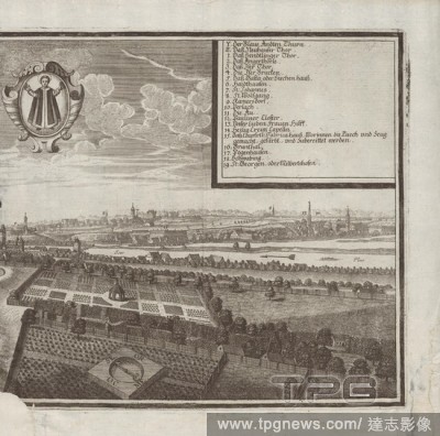
EditorialMunich, Munich with Isar (Germany), Fig. 4, Wening, Michael (del. et sc.), 1701, Michael Wening: Historico-topographica descriptio. Das ist: Beschreibung, dess Churf?rsten- und Hertzogthumbs Ober- und Nidern Bayrn, welches in vier Theil oder Rennt-Aemb...
EditorialGerman landscape (Isar landscape), 1900-1901, tempera on linden wood, 63.5 x 99 cm, signed and dated center left, above the house entrance: ALBERT WELTI, 1900-1901, Albert Welti, Z?rich 1862?1912 Bern.
EditorialNapoleonic map. Territory between the German rivers Inn and Isar, tributaries of the Danube. Atlas de l'Histoire du Consulat et de l'Empire. History of the Consulate and the Empire of France under Napoleon by Marie Joseph Louis Adolphe Thiers (1797-187...
EditorialNapoleonic map. Territory between the Danube and Isar rivers, from Regensburg to Landshut (Germany). Atlas de l'Histoire du Consulat et de l'Empire. History of the Consulate and the Empire of France under Napoleon by Marie Joseph Louis Adolphe Thiers (...
EditorialHunter and Lord at the River Isar with View of Munich, 1823. Wilhelm von Kobell (German, 1766-1853). Oil on wood panel; framed: 38 x 33.5 x 6 cm (14 15/16 x 13 3/16 x 2 3/8 in.); unframed: 25 x 20.6 cm (9 13/16 x 8 1/8 in.).
EditorialNapoleonic map. Territory between the German rivers Inn and Isar, tributaries of the Danube. Atlas de l'Histoire du Consulat et de l'Empire. History of the Consulate and the Empire of France under Napoleon by Marie Joseph Louis Adolphe Thiers (1797-187...
EditorialNapoleonic map. Territory between the Danube and Isar rivers, from Regensburg to Landshut (Germany). Atlas de l'Histoire du Consulat et de l'Empire. History of the Consulate and the Empire of France under Napoleon by Marie Joseph Louis Adolphe Thiers (...
EditorialMapa del territorio comprendido entre los r?os Danubio e Isar, de Ratisbona a Landshut (Alemania). Historia del Consulado y del Imperio de Napole?n (Atlas de l'Histoire du Consulat et de l'Empire). Obra de Marie Joseph Louis Adolphe Thiers (1797-1877)....
EditorialMapa del territorio comprendido entre los r?os alemanes Inn e Isar, afluentes del Danubio. Historia del Consulado y del Imperio de Napole?n (Atlas de l'Histoire du Consulat et de l'Empire). Obra de Marie Joseph Louis Adolphe Thiers (1797-1877). Dibujos...
EditorialMapa del territorio comprendido entre los r?os Danubio e Isar, de Ratisbona a Landshut (Alemania). Historia del Consulado y del Imperio de Napole?n (Atlas de l'Histoire du Consulat et de l'Empire). Obra de Marie Joseph Louis Adolphe Thiers (1797-1877)....
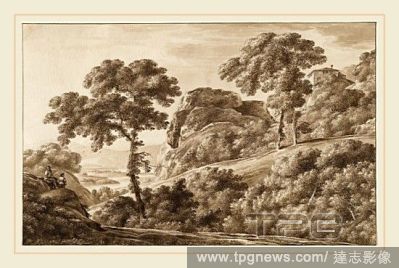
EditorialFranz Innocenz Josef Kobell, German (1749-1822), The Isar with Boulders on the Isarhohe, 1809, pen and brown ink with brown wash over traces of graphite on laid paper.


 Loading